The soil profile beneath Jersey City tells a story of dramatic geological transition. A project near the historic brownstones of Paulus Hook often encounters the well-draining sands and gravels of the ancient river delta, while excavation just a few blocks west in Journal Square can quickly hit the deep, compressible varved clays and silts deposited by Glacial Lake Hackensack. This sharp variation—shifting from granular to cohesive soils within a single city block—makes a standard test pit inspection insufficient on its own. A precise grain size analysis following ASTM D2487 is the only way to quantify that shift, giving structural engineers the exact particle distribution needed to predict drainage, frost susceptibility, and bearing behavior. In a city where tidal influence from the Hackensack River raises the groundwater table to within a few feet of the surface, knowing the silt and clay fraction is not a technical luxury—it is the baseline for every foundation decision.
A single grain size distribution curve can distinguish between a soil that drains freely and one that will hold water against a foundation wall for months.
Service characteristics in Jersey City
Critical ground factors in Jersey City
A mid-rise residential project on a constrained lot near Bergen Avenue ran into trouble when the excavation revealed a pocket of silty sand with a fines content above 15 percent. The geotechnical report had assumed clean sand based on a preliminary boring log, but the grain size analysis we performed told a different story: the material was actually an SM, highly susceptible to strength loss when saturated. If the contractor had proceeded with the original shallow footing design, differential settlement could have cracked the concrete within the first two years. The curve from the hydrometer test showed a sharp rise in the silt fraction between 10 and 50 microns, a signature of Jersey City’s estuarine deposits. This let the structural engineer re-run the bearing capacity calculation with a more conservative friction angle and switch to a mat foundation design that spread the load more evenly. In Hudson County, where relic marsh deposits hide beneath urban fill, skipping the hydrometer portion of the test is the single fastest way to misclassify a problem soil.
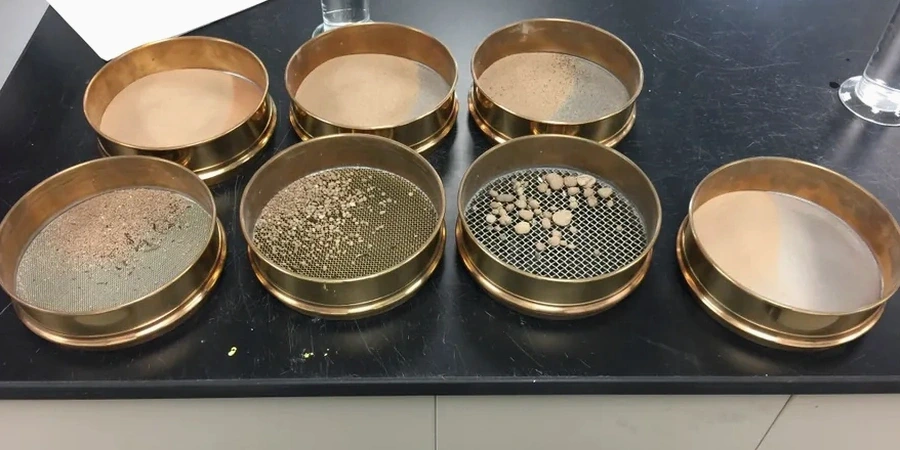
Our services
Our Jersey City soil testing program integrates grain size analysis with complementary field and lab methods to build a complete geotechnical profile for your site.
Mechanical Sieve Analysis
Full stack shaking from coarse gravel to fine sand per ASTM D422, with washed No. 200 separation to determine the exact fines content of granular soils.
Hydrometer Sedimentation
ASTM D7928 analysis of the minus 200 fraction using a 152H hydrometer, providing the silt and clay distribution curve over a 24-hour settling period.
Soil Classification Reports
Complete USCS classification with group symbol, Cu and Cc coefficients, and a particle size distribution chart ready for inclusion in geotechnical baseline reports.
Fill Material Compliance Testing
Routine gradation checks on imported structural fill, pipe bedding, and drainage aggregate to confirm the delivered material matches the project specification before placement.
Common questions
How much does a grain size analysis cost for a Jersey City project?
A standard sieve plus hydrometer analysis typically runs between US$110 and US$160 per sample, depending on whether the soil is predominantly granular or fine-grained and how many sieves are required for the full curve.
How long does the hydrometer test take to complete?
The sedimentation process requires readings at specific intervals over a minimum of 24 hours to capture the full silt and clay distribution. With sample preparation and data reduction, final results are usually ready within 2 to 3 working days.
What sample size do I need to deliver for a complete gradation test?
We require approximately 500 grams of dry soil for sands and gravels, and around 200 grams for silts and clays. The sample should be sealed in a moisture-tight bag immediately after collection to preserve the natural water content.
Can you classify the soil type from just a sieve test without the hydrometer?
You can get a rough gravel-sand-silt split, but the USCS group symbol for fine-grained soils (silt vs. clay) depends on the hydrometer curve and the Atterberg limits. Without the sedimentation analysis, you risk calling a plastic clay a non-plastic silt, which has serious consequences for foundation design.