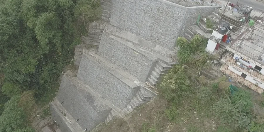
When we pull up to a site in Jersey City with a CPT rig or a track-mounted drill, the first thing we look at isn't the slope itself—it's the surrounding infrastructure. You’ve got retaining walls holding back fill from the 1800s, stormwater culverts that predate modern drainage standards, and brownstone foundations perched above the Hackensack River floodplain. The slope stability analysis we run here has to account for all of that. We start by mapping the stratigraphy with field methods like the sondaje SPT to log refusal depths and identify soft layers, then feed that data into a limit equilibrium model—Spencer or Morgenstern-Price, depending on the geometry. Jersey City sits on a mix of glacial till, varved silts, and historic fill, so the failure surface can cut through three different materials in less than 20 vertical feet. Our team has handled slope assessments for the Palisades escarpment, for brownfield redevelopment along the Hackensack waterfront, and for excavation support near the Holland Tunnel approach, where a miscalculated factor of safety isn’t just a design problem—it’s a public safety issue.
In Jersey City, the critical slip surface often follows an old utility trench or a forgotten foundation wall—cross-referencing Sanborn maps isn’t optional, it’s standard practice.
Service characteristics in Jersey City
Critical ground factors in Jersey City
What we’ve noticed after years of working sites from Greenville to the Heights is that the most dangerous slopes in Jersey City aren’t the obvious ones. It’s the 12-foot cut behind a three-family walk-up, where stormwater from the roof drains straight into the backfill and saturates the clay seam nobody mapped. Or the embankment along a light rail extension where vibrations from passing trains have been ratcheting pore pressure for a decade. A slope failure here rarely happens all at once; it starts as a tension crack after a heavy nor’easter, widens over a few freeze-thaw cycles, and then lets go during a spring rainstorm. The IBC and local building code require a minimum static factor of safety, but we routinely recommend higher values when the consequence of failure includes a public right-of-way or a neighboring structure. And we never sign off on a slope design without a drainage plan—surface water control is the cheapest insurance against a stability failure in this climate.
Our services
A slope stability analysis report has to do more than satisfy a permit checklist. It needs to give the design team and the contractor a clear picture of where the risk is concentrated and how to mitigate it. These are the core services we provide as part of a slope assessment in Jersey City:
Slope stability modeling and cross-section development
We build 2D and 3D models using site-specific soil parameters derived from lab testing and field investigation. Each deliverable includes pore pressure contours, critical slip surfaces, and a table of factors of safety for static and pseudo-static conditions, with clear recommendations for reinforcement or regrading where required.
Field investigation and instrumentation for slope monitoring
We deploy inclinometers, piezometers, and survey monuments to track slope movement and groundwater response over time. For active construction near slopes—like foundation excavation or utility installation—we set up real-time monitoring with threshold alerts tied to the stability model.
Common questions
What does a slope stability analysis typically cost for a site in Jersey City?
For a standard lot or small commercial parcel in Jersey City, the analysis—including field investigation, lab testing, and limit equilibrium modeling—generally falls between US$1,330 and US$4,790. The range depends on slope height, access constraints, and whether groundwater monitoring is needed. Larger or more complex sites with multiple cross-sections or seismic analysis requirements will push toward the upper end or beyond.
How do Jersey City's fill soils affect slope stability calculations?
The historic fill across much of Jersey City is highly variable—it can contain demolition debris, cinders, organic silt, and dredge material, often in layers only a few feet thick. This variability means we can’t rely on textbook parameters. We sample the fill directly and test for strength, moisture sensitivity, and collapse potential. In many cases, the fill controls the critical slip surface because it’s weaker than the underlying glacial deposits, especially when saturated.
Do I need a slope stability analysis for a retaining wall replacement?
Almost always, yes. In Jersey City, older retaining walls are frequently undercut by slope creep or undermined by leaking storm drains. Replacing the wall without analyzing the slope behind it is a common cause of construction-phase failures. We model the slope with and without the wall to determine whether global stability requires reinforcement beyond the wall itself—such as tiebacks, soil nails, or regrading. More info.